http://en.wikipedia.org/wiki/Digital_elevation_model
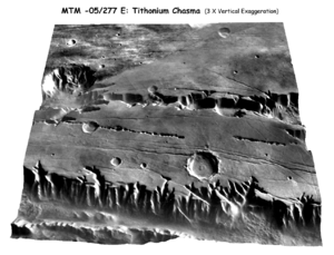
DEM is an acronym for Digital Elevation Model. It is a 3-D representation of a terrains surface.It is commonly used to model terrains of other planet or moons. It helps those who study meteorology. This specific example is a model of the terrain of the planet Mars.
No comments:
Post a Comment